Geolocation and analysis of today’s battles inside Vuhlehirs’k

Most recent footage of two Russian camera teams provide unique and revealing insights into the current ground property situation and the course of the battles in Vuhlehirs’k. To understand the latest development in the battle for the town and give an (as most as possible) objective picture of it, I geolocated all available footage piece by piece, gaining insightful and partly surprising results.

Snipers at the southern gas station

The first footage is mainly located in the very south west of the city, only 100 meters from the town’s entrance sign along the M04 / E50. The camera team met the Russian troops at the N-W former Ukrainian army checkpoint. The next scene shows them approaching the M04 from the east, coming from a small street and not the main road, which would have been the fastest way. This way seems not to be safe to walk. They are crossing the M04, running and obviously afraid of snipers in the area.

fuel1

Only when seeking shelter in some of the buildings nearby, they (the Russian media guys and soldiers) relax. As soon as they enter an open area with a wider sight line, they almost panic, being sure, there are Ukrainian forces in the area. Another scene shows them returning to the east of the city, starting on the other side of the read, this time with the gas station in the background. There is not much shooting audible, but the situation seems tense nonetheless. During the video, a former Ukrainian position as well as one to two dead Ukrainian troops can be seen but also seemingly disabled Russian vehicles, namely a BMP-1 and an Ural truck.

fuel2

I mapped the entire ways, the footage shows with the “outbound trip” marked in read and the way back marked in orange.

fuel map

Battle for the apartment block

Another Russian state TV team is filming in the geographical center of the city, being embedded with Russian troops, storming and Ukrainian army observation and sniper position in the highest residential building of the town, situated among the only agglomeration of large apartment blocks in Vuhehirs’k. The first scene is a brutal as unsurprising with a RF armed forces T-72 firing shell after shell into the eleven-story building, making sure, Ukrainian fire from the building ceases before the further advance.high rise 1

Shortly after, Russian ground forces advance towards the apartment block from the north, using classic motorized infantry cover tactics, moving within the protection of a BTR-80.

high rise 2

After arriving between the high rise buildings, they enter the buildings searching for surviving Ukrainian troops. There is no shooting audible, so those troops might have fled or be dead by then. Finally the officer of the Russians is interviewed. I marked this picture as it was my starting point of geolocation (comparing it with a picture from the same house on Google Earth).

high rise 3

The final map geolocates the entire path the Russian troops took to approach and storm the apartment complex, revealing further insights into the who owns what across the city.

map high rise

What does all this tell about the current situation in Vuhlehirs’k?

Mainly that the tactical situation is much more complicated than previously thought. The Ukrainian claim that they recaptured – or rather: re-infiltrated – many areas of the town after January 30 seems to be accurate and the Russian narrative of “full control” proven wrong (by their own footage). At the same time it can be once again concluded that Ukrainian troops in Vuhlehirs’k are severely outgunned, outnumbered and generally in a rather defensive position plus losing territory – once again, one might say. While Russian forces use BMP, BTR and main battle tanks inside the city limits, Ukrainian troops seem to rely on light vehicles (as can be seen in the footage) and light infantry units.

Finally the above and previously analyzed footage from earlier today allows to create a very current and much more founded map of today’s ground property situation among the involved parties. It shows that the situation is more complicated than 4 days ago when Russian forces controlled 90%-100% (also admitted by Ukrainian govt sources) and Ukrainian reinforcements have indeed entered almost all parts of the city. However, it also shows, they are under serious threat of losing it once again. Also the fact that Ukrainian troops seem to be mainly located in the center and southern part without heavy weapons or a stable resupply line contains the great threat of another encirclement by getting cut off from the main force in Debaltseve to the east and Artemovsk to the north west… The battle for the town continues.

map 3.2.2015

Estimate map for 03.02.2015, based on analyzed footage

Footage-based analysis of the current developments in Vuhlehirs’k

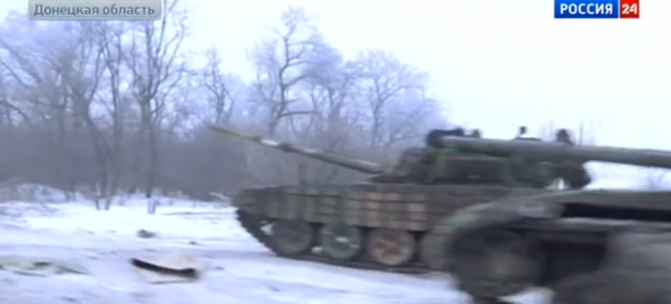
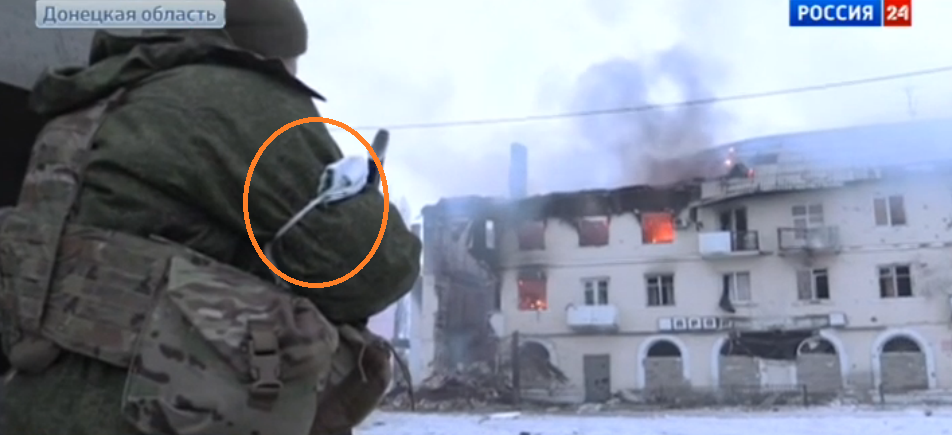
Over the last four days (since my article on the Russian storm on Vuhlehirs’k), the situation around the current battle focus town of Vuhlehirs’k was hazy to say the least with Russian forces claiming, they controlled all of it and advanced further to the north and north east while the Ukrainian army said, they dealt devastating blows to the “terrorists and Russian Federation troops” in the area. Just today, the Ukrainian army’s spokesperson Lysenko talked of a “mass death” of militants, after they “came out of the settlement” as they were “covered” with artillery and missiles – inside. However, he also said, the surviving troops were “chased” back in by their commanders to hold it. Meanwhile, what he did not say (during the last 4 daily pressers) was whether Ukrainian troops managed to re-occupy certain or all areas of the town or if all “Ukrainian counterattack” is just a matter of extreme artillery and MLRS fire from outside.

Such extremely contrary statements by both sides involved made it very difficult  to assess the situation from a fact-based perspective, not relying on claims, but veritable pictures from the ground. These pictures were not available since January 30 from neither side, making an objective evaluation of the situation virtually impossible. This changed today.

Evacuation of civilians

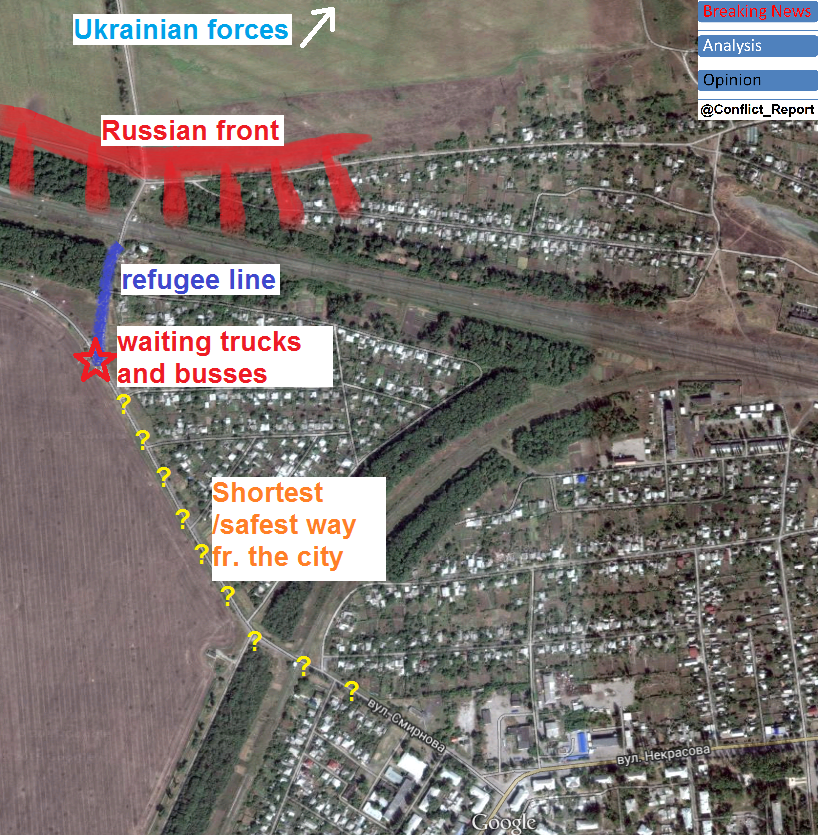
In the early morning of February 3, 2015, Russian media claimed, there was a “humanitarian ceasefire” in Vuhlehirs’k between the two involved parties, giving hundreds of civilians the opportunity to flee “to the safety of the DNR and Makeevka”. The Russian narrative was that all civilians in the town were “terrorized” by the Ukrainian shelling and willing to flee to Russian-held areas. Shortly after these statements, first footage appeared of what indeed seemed to be civilians lining up at the (geolocated) western railroad crossing of Vuhlehirs’k and being transported into Russian-held territory by trucks and busses. Shortly after another Russian news station reported with footage from the same area.

evacuation

evacuation of civilians

There are two possible conclusions to be drawn from the footage concerning the situation in and around the city.

It seems generally unlikely that Ukrainian civilians would cross the frontline to get evacuated – even in case of a local ceasefire for several hours. Hence, it is more likely that civilians are willing to get evacuated by the respective side controlling the territory they live in. Therefore one conclusion would be that the Russian side indeed controls much of the town as several hundred civilians via their exit points of it. Not because they would be anymore aligned to their side, but simply because it is the safest way to leave the death zone. This would support the Russian narrative of wide control over the area.

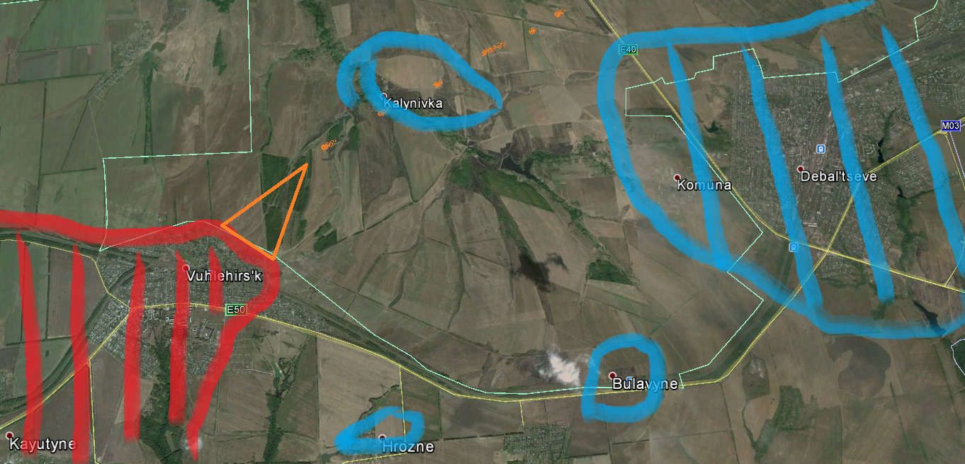
At a second glance, something seems odd about the footage and queuing people especially as both Russian channels use exactly the same way to follow the line from its end to its start and the ready-to-go buses and Ural truck. If these people really would come from the main inhabited areas of Vuhlehirsk, they would line up from the east or south east, where two larger streets lead into the city. Instead, they seem to have come from the north, a direction where almost no residential buildings are situated, but the frontline between Russian and Ukrainian positions, thus two reasons speaking against taking that way to seek safety. The below map visualizes this setting.

fake

the “evacuation” setting

This raises the question, if all of those refugees really come from the city and left it via the most dangerous way and from a direction where only few people live. Or if some of them were only moved their for the sake of some positive PR for the involved Russian army. Another possible reason is that such a “humanitarian gesture” could be a good pretext to regroup or hide own repositioning efforts in the area. In the footage, some 300-500 civilians can be seen lining up and several civilian busses as well as military truck are waiting to pick them up. This could mean that only a smaller part of the formerly 7000 inhabitants counting town is under control of the Russian army, however there is no conclusive evidence for that in the footage. In conclusion, the shown “evacuation” footage leaves some questions open while indeed showing, Russian forces control the western entrance of Vuhlehirs’k and there was no fighting before noon today. (parapgraph updated due to new footage and information) Also see Update at the end of the text.

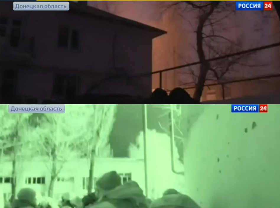
Scenes from inside the city

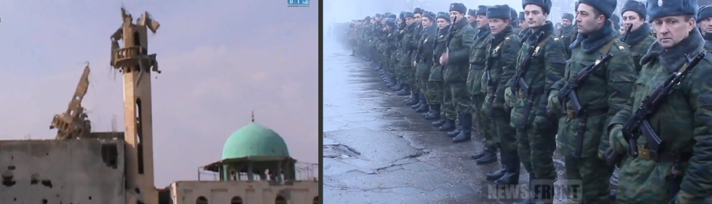
Beside the scenes from the far west of Vuhlehirs’k Russian media footage included more pictures, giving a deeper insight into the situation. There is one video, summarizing all that footage, which will be analyzed in the following paragraph. The first scene shows a T-64BV with its turret blown off by what must have been caused by a major impact. Another destroyed truck can be seen as well in the picture. The wreckages can be geolocated some 100 meters to the N-W of the main intersection of the town.

T-72

destroyed T-72 close to the center

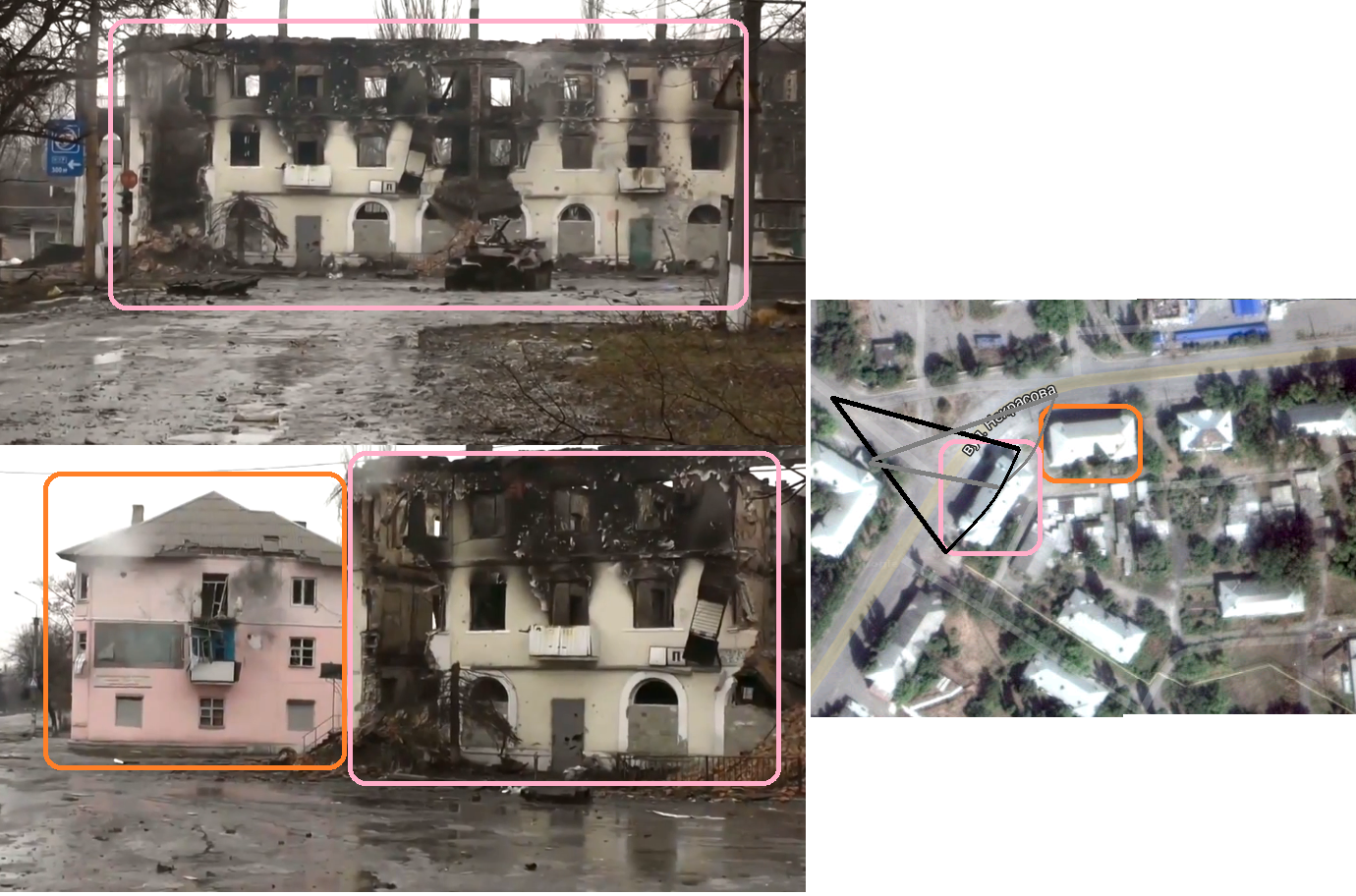
Two more geolocated images show the central intersection, which was already the scene of fighting on January 29.

center

the center of Vuhlehirs’k

From this footage, several conclusions can be drawn about who controls what in the town. At first, the Ukrainian claim that “all militants were killed and destroyed” in Vuhlheris’k can be falsified. Russian forces control at least the western and central part of the embattled city as the footage shows. Moreover, no military vehicles or defensive positions can be seen which means the actual frontline should be further to the east, leaving the center with the M04 behind the front and in Russian hands. However, it is also telling that Russian TV crews could not take any footage at the formerly held train station or the northern end of the town with its distinctive church (as shown several days ago). The below map shows what can be regarded as surely under Russian control in the city, taking into account the above stated reasons (e.g. safe to record by Russian TV, safe roads to get their plus the lack of real frontline positions).

who controls what

overall situation map

Conclusions

So what can be concluded from the available footage?

1. There is still no proof that Ukrainian forces control any territory in or around Vuhlehirs’k. Due to the lack of available footage, recorded by the Ukrainian army or embedded media branches, the claim that “heavy fighting is ongoing across the city” can not be verified, however also not totally falsified. It is possible that Ukrainian units are still fighting inside the town, but such claim should be backed by at least one datable and geolocationable picture or video.

2. Russian forces hold major parts of the city. The analyzed footage shows that Russian forces still have a foothold in Vuhlehirs’k. Despite being hit hard by Ukrainian artillery and missiles, their presence in the west, center and thus surely also in the south can be verified.

3. It remains unclear, how much exactly the Russian army controls of the town. As stated above, the observed footage lacks the final proof, Russian forces control the entire regarded town, despite several indication is there, this might be the case. However, the situation at the real frontline seems to be regarded as too dangerous to film for Russian media or there are other reasons, why the Russian leadership is not willing to publish footage from the northern and eastern parts of Vuhlehirs’k.

Last but not least, two more images from the latest footage should be considered. The first shows what appears to be a unexploded BM-27 missile, stuck in the mud, just beside the destroyed T-64. It is not unreasonable to infer that the Ukrainian army is shelling the Russian-held center (and possibly other parts) of the town Vuhlerhirs’k with 220 mm calibre missiles from the type “Uragan” despite the certain possibility that civilians may still be residing inside the town. Footage of such an attack could be seen in the January 29 footage and the fact that the Ukrainian army is “covering” the Russian invaders in the town is emphasized almost daily by the Ukrainian army command.

BM-27

Unexploded BM-27

The second picture is another piece of evidence that no one but the regular Russian army is leading the fight vs. Ukrainian forces across Donbas. It shows the hit wreckage of a Russian army Ural-4320 truck, still bearing the typical unit identification mark at the vehicle’s bumper. This is another reminder to European media that no “separatists” are battling the Ukrainian army, but the armed forces of the Russian Federation. Also and especially at the battlefield of Vuhlehirs’k.

ural 4320

Russian army Ural-4320

Please support my work, producing independent and fact-based analysis on the situation in Ukraine with 1$ per month or more. Click here.

Update

Pictures that appeared after this article was published indeed show, queuing civilians were likely asked to do so, facing the pick-up point from the north and the rail tracks. However it appears they originally came from the south east, so from the city itself. They were probably asked to take this “odd” 400 meter detour to keep the main road clear for other refugee cars and military vehicles passing by. This means that the chance, some of them were only “moved there” for any purpose is much less likely. – New facts bring new insights. That’s the way it is.

detour

Route of fleeing civilians towards the buses and trucks

The beginning of the end – Russian forces take Vuhlehirs’k

It comes as no surprise that yesterday around noon, strong Russian army forces started their so far heaviest assault on the 7800 souls town of Vuhlehirs’k, the second biggest town within the so-called “Debaltseve bridgehead”, a territory held by the Ukrainian army and volunteer corps between the Russian-ruled “republics” of Donetsk and Luhansk. A look at the official “ATO map” shows the strategic significance of the town, not only being the last fortress between the Russian military hub of Horlivka and Ukrainian-held Debaltseve, but also key to the only open resupply route between Debaltseve and Artemivsk, further to the west. The only road, the M03, runs just 5 km to the north east of the town and whoever controls all of Vuhlehirs’k also controls the movement between some 5000 Ukrainian troops east of it and the rest of Ukraine (map).

ato map

tactical map

Hence, it was an imperative for Russian troops to capture this town, before starting the direct attack on Debaltseve. As a matter of fact, controlling Vuhlehirs’k and the territory to its north could even avoid a direct assault on Debaltseve as a lasting siege would force thousands on Ukrainian troops to surrender without a fight, running out of food and ammunition. The general Russian strategy in the area was also described in my article from January 27, predicting “the fall of Debaltseve is inevitable […] if there is no radical change in tactics”. As there is no sign on the horizon of this change to come, regular Russian army forces began their assault from Horlivka in the west and Kayutyne in the south on January 29. While on this day, only little footage was published, showing that they overran the outer defensive line of Vuhlehirs’k, losing at least one T-72B1 and taking several Ukrainian soldiers POW, early January 30, Russian state TV published extensive video footage of the battle and its aftermath. Already on the way to Vuhlehirs’k, many Russian army T-72 main battle tanks could be seen, proving this is no further faltering skirmish, but indeed the long anticipated major push, military forces would conduct from the daily resupplied and reinforced areas north east of Donetsk city.

T-72

T-72 on the road to Vuhlehirs’k

The following footage shows the brutality of the battle that took place on the western and southern entrances of Vuhlehirs’k, where Ukrainin forces put up fierce resistance and destroyed more Russian tanks (see picture below) and likely also many troops, which are not shown on Russian footage, but were outgunned and defeated in the end, allowing the Russian army to enter the center of the town.

T-64BV

destroyed Russian T-64BV (no Ukr IFF)

Next scenes of the analzed footage show the very center of Vuhlehirs’k, where fighting still took place and residential buildings around the main intersection of the M04 highway were burning. Some Ukrainian troops seemed to still resist as shooting was aubilbe and Russian forces were still in a cautios and nervous mood.

Russian soldier

Russian soldiers in the center of the city

When the situation calmed down a little bit, Russian TV teams were able to take wider shots of the area, making it possible to geolocate and thus verify the footage. This enabled a clear confirmation of the fact that – at least yesterday afternoon – Russian forces were present in the center of the city, dominating its vital route to Debaltseve itself.

city

Geolocation of the Russian advance

At the same time, this geolocation and taking into account the previously analyzed footage made the creation of a strategic map of the battle and ground possession status possible – again – for this time yesterday afternoon. It shows that Russian forces indeed stormed Vuhlehirs’k from Kayutyne just south of it and a long the railway to the west, so from Horlivka and its suburbs. Both (footage analysis-based) assault directions were later confirmed by Ukrainian journalists and soldiers on the ground.

map

Strategic map of the battle

The crucial question remains, what happened after yesterday afternoon. While the Russian propaganda claims, it caputred most of the town and the battle is effectively over, various Ukrainian sources paint totally different pictures of the situation. The commander of the well-known Ukrainian national guard force “Battalion Donbas” for example, said this morning on his facebook page that the town was lost. Shortly after, reports from journalists on the ground said, Ukrainian forces would hold the northern and eastern part of the town, starting from the train station. This version would perfectly correspond with the created map above. However in the afternoon, the Ukrainian government’s MP and interior ministry member Anton Gerashchenko claimed that entire Vuhlehirs’k was back under Ukrainian control due to “accurate artillery strikes and daring maneuvers of our tanks”. It is telling that this most official statement so far also claimed, Russian troops only managed to capture a “suburb” of the town yesterday, but were repulsed. A flagrant lie as this article has proven. But what really happened last night? Russian media footage shows intense Ukrainian multi launch rocket system attacks. On the center of Vuhlehirs’k – and on Russian troops stationed their overnight. However, what is not shown are Ukrainian tanks or ground troops re-entering the city or any fighting from the Russian side. Instead it ends with Russian tank drivers, showing the victory sign on broad daylight.

MLRS

MLRS attacks on Russian forces overnight

Despite the fact that it remains unproven if the latest scene really shows the day after or the time before the Ukrainian artillery / MLRS “counterattack” during the night, it must be doubted that the Ukrainian army either has the technical and manpower-related capabilities in the area to launch a counteroffensive on hundreds – if not thousands – of well-armed Russian troops in the town, enyjoing a steady flow of resupplies from Horlivka and Yenakijeve. Therefore, my final assessment of the claim would be that we are talking about the same “repelling” successes as were claimed for 5 days over the new terminal of  Donetsk airport. All turning out to be untrue.

Update —

Shortly after the article at hand was published (in the evening hours of January 30), Russian LifeNews brang a report from Vuhlehirs’k, proving that the city has entirely fallen to Russian army forces and Ukrainian counteroffensives – if there were any – totally failed. Video footage does not only show heavy tank and apc forces (T-64BV, T-72B1, BMP-2) inside the town today.

tanks

Russian tanks and apc

It also contains geolocatable footage of a church in the northern outskirts of the town, showing Russian forces pointing their rifles to the north and the LifeNews “journalist” (not!) reporting without cover from possible small arms fire. According to the LifeNews report, Ukrainian forces were pushed out of the town and are shelling it with mortars and artillery from Kalynivka in the north and Debaltseve. This seems to correspond with the footage itself.

geolocation

Geolocation in northern Vuhlehirsk

From a larger distance, the geolocated footage is evidence that Russian forces took over (at least) 90% of the town including the strategic train station, which was the front line earlier this morning according to this article (read above) and Ukrainian journalist reports.

map

city map

Looking at the powerful involved forces (dozens of tanks, apc and hundreds to thousands of Russian troops), there seems to be no chance the Ukrainian army will recapture the area (as it did not recapture ANY Russian-taken area since September last year). Knowing that the Russian forces are as quickly as possible moving northeastwards, it becomes clear where their aim lies. The target is to cut the M03 as soon as possible, creating a pocket with more than 5000 Ukrainian troops in Debaltseve. Looking at the speed of their advance, this might become true within days rather than weeks.

maplarge

regional map

End of the update —

In conclusion, I might sound once again like a broken record. I wrote 3 days ago “if there is no radical change in tactics by the Ukrainian side”, it will not only lose the “bridgehead” of Debaltseve, but entire Donbas. I continued warning that “purely defensive operations against an enemy with the fire – and man – power observed in eastern Ukraine during the last 4 weeks, leads to sustained territorial losses.” I have nothing to add to these statements beside calling upon the Ukrainian government once again: Act now or start digging trenches on the eastern outskirts of Kharkiv and Zaporizhia. Because this is where the current course of the fighting is leading sooner rather than later.